
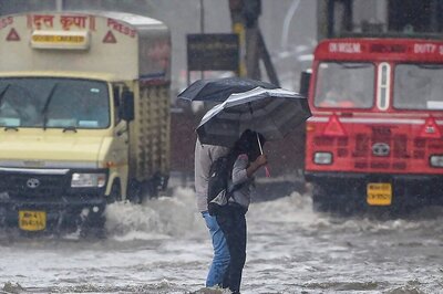
Bearing the brunt of one of the longest fog spells in recent years, northwest India also recorded its second-lowest January rainfall in 123 years with a deficit of at least 91 percent. The IMD said the rainfall deficit across India as a whole ended at 58 percent.
The snowless start to the year triggered widespread concerns for the Himalayan states, which remained largely dry until Tuesday (January 30). The recent bout of fresh snowfall, however, has managed to blanket the hill states. This is on account of two strong western disturbances passing through the region successively this week till February 4.
“The rainfall deficit was mainly due to less active western disturbances this time. Even the ones that impacted were very feeble. Also, we generally do not see much rainfall during January, but this time it was exceptionally low. Our multi-model ensemble forecast also could not predict it, especially for the northwest plains,” said Dr M Mohapatra, director-general of meteorology.
Why couldn’t the IMD predict the dry winter?
The exceptionally dry winter also seems to have come as a surprise for the weather department, which had predicted above-normal rainfall for the plains in seven subdivisions of northern India in January. Four western disturbances impacted the region starting January 3, but all moved across the extreme north of India and were quite feeble leaving most hilltops dry and snowless.
According to Mohapatra, this was probably due to a weather phenomenon called the North-Atlantic Oscillation (NAO) Index. “We realised that it was the root cause for the deficient rainfall. When the NAO Index is negative, it becomes unfavourable for winter precipitation,” said the IMD chief.
Meteorologists also pointed to a long-term trend of decreasing frequency of western disturbances (WD) over north India from December to February, since 1990 – a pattern linked with rising global temperatures and climate change.
“The total amount of winter precipitation is decreasing. Certainly, the WDs are shifting more towards the north. But it does not mean that it will be less every year,” Mohapatra added.
Longest fog spell and cold days
Amid the scarce winter rain, the entire north India found itself enveloped in one of the longest fog spells starting December 25, which has continued to this date. This also led to over 10 to 15 cold days over the Indo-Gangetic plains as temperatures plunged below normal.
The intensity of cold waves, however, was far lower and impacted a smaller area this time – mostly parts of Punjab, Haryana, north Rajasthan, Delhi and parts of Uttar Pradesh. The monthly mean minimum temperature for January was recorded to be around 14.6 degrees Celsius, which is slightly above the long-term average of 13.6 degrees Celsius, while it was around 5.5 degrees Celsius for northwest India that witnesses its peak winter in January.
‘Above normal’ rains in February
The IMD is confident of above-normal rains during February, not just for north India but also for the country as a whole except for south peninsular India. February continues to be a winter month, but the day and night temperatures will gradually start rising, and overall expected to be above normal during the month.
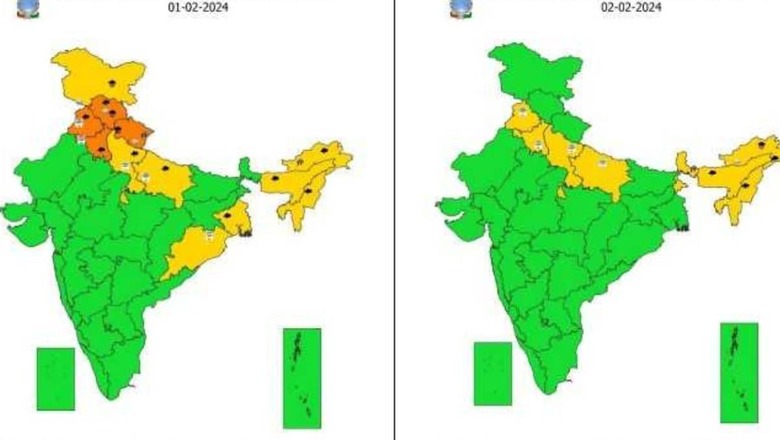
The latest forecast indicates no cold days or cold wave days over the country in the next five days. North India will remain under an intense spell of winter rains and snowfall till February 4, with peak intensity on February 1 and February 3 to 4, with most days likely to be cloudy.
Parts of Punjab and Haryana as well as Delhi may witness isolated hailstorm on Thursday (February 1), while strong and chilly surface winds of 30 to 40 kmph are expected to sweep the region. The weather department has also sounded a warning for dense fog till February 3.
Strong El Nino continues, but may weaken from April
The IMD further said the strong El Nino conditions in the equatorial Pacific Ocean continued in January, but are likely to reduce from April. The forecast suggests a good 75 percent probability of El Nino turning into ENSO-neutral during April-June, which may augur well for the southwest monsoon.
Mohapatra went on to add that most models indicate a quick transition to La Nina around July-September, which means that surface temperatures over the Pacific Ocean may turn cooler. This is believed to be favourable for good monsoon rains over India. The IMD, however, will update its forecast next month.


Comments
0 comment