views
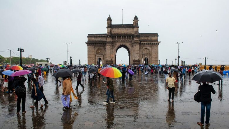
After a slow and steady start, the southwest monsoon has begun to gain strength and marked its onset over Mumbai and other parts of Maharashtra on Saturday. In a piece of good news, the conditions are turning favourable for its further progress into Gujarat, some parts of Madhya Pradesh and more parts of Andhra Pradesh over the next few days.
Providing major relief from the sweltering heat, moderate to heavy rains lashed Mumbai and other adjoining districts over the last two days. The India Meteorological Department (IMD) has predicted more rainfall activity over the next five days. There is also a strong likelihood of thunderstorms in parts of Pune, Nashik and Ahmednagar.
“Monsoon normally arrives over Mumbai around June 9-11, so its progress is normal so far. All districts of Konkan have received moderate to heavy rains continuously over the last two days. The monsoon will further cover more parts of Maharashtra during the next two days. It will also show some progress on the eastern front and advance into West Bengal, Jharkhand soon,” said RK Jenamani, senior scientist at National Weather Forecasting Centre, New Delhi.
After making its arrival over the Indian mainland on May 29, the monsoon entered into a slightly weaker phase with a sluggish progress. As of June 11, the country faces a rainfall deficit of 42 per cent with as many as 27 out of 38 subdivisions deficient in rains. The rainfall has so far been normal in only seven subdivisions which include parts of Tamil Nadu, Karnataka, Rayalseema, Bihar, Arunachal Pradesh and Andaman and Nicobar Islands. On the other hand, it rained in excess in Assam, Meghalaya and Sikkim.
According to the latest update, the monsoon, which is responsible for providing over 70% of the annual rains to the country, has now covered most parts of Konkan, including Mumbai, some parts of Madhya Maharashtra, some more parts of Karnataka, Kerala, and Tamil Nadu. The northern limit of the monsoon currently crosses Pune, Bengaluru, Puducherry and Siliguri.
On Track, Says IMD
However, allaying concerns over its sluggish progress, Dr KS Hosalikar, senior IMD scientist and head, climate research and services, IMD Pune, said the monsoon remains on track and there should not be any cause of concern.
“No matter which year we take, the journey of the southwest monsoon from Kerala to north-west parts of Rajasthan when the monsoon is said to have covered the entire country is not always the same. The onset lines are not uniformly distributed, and it varies from year to year. Every time, there is a possibility that it will halt at some place, and wait for favourable conditions to develop and then it moves. It was slightly weak initially, but it is reviving now,” he added.
According to agro-meteorologists, the farming community — especially in the northern and central states — also need not worry as a slight delay in the progress of the monsoon, if any, would not have a direct impact on sowing of crops. The sowing window for most Kharif crops (rainfed crops) starts on June 15 and continues for over a month.
“Monsoon does not always arrive on pre-determined normal dates, and there can always be a delay of 7-10 days. But there is nothing to be anxious about, as there is a long sowing window until beginning of July. What is important is that once it arrives, the rainfall is normal so that there is good moisture in the soil after the sowing of crops. So, we still have ample time. Monsoon anyway arrives over northwest parts in June-end,” said KK Singh, senior IMD scientist.
The weather department has also assured that the delay in progress of monsoon over the country may not affect the overall quantum of rains. The IMD has predicted normal rains for the country this year, with a higher probability of above normal rains for the rain-fed agricultural states. The department had recently upped its monsoon forecast from 99% to 103% of LPA — the long period average is based on the average rainfall for the period from 1971-2020 and stands at 87 cm.
“Southwest monsoon always arrives in weak and strong phases. It started off on a weaker note, but it is showing signs of organising now, and the forecast suggests, it will definitely pick up during the coming days. All this is part of the natural variability of the monsoon. There have been many years in the past when June has received below normal rains in the first half, but good rains towards the month-end have made up for that deficit,” said DS Pai, Director of Institute of Climate Change Studies.
According to the latest forecast, the monsoon will most likely cover remaining parts of Konkan, some parts of Gujarat state, most parts of Madhya Maharashtra, entire Karnataka and Tamil Nadu, some parts of Telangana, Andhra Pradesh, Westcentral & northwest Bay of Bengal over the weekend.
The conditions are becoming favourable for further advance of monsoon into some more parts of north Arabian Sea, some parts of Marathwada, Gujarat, some more parts of Telengana, Andhra Pradesh, most parts of Bay of Bengal, entire Sub-Himalayan West Bengal & Sikkim, some parts of Odisha, Gangetic West Bengal, Jharakhand and Bihar during the subsequent two to three days.
Read all the Latest News , Breaking News , watch Top Videos and Live TV here.


Comments
0 comment