
Getting Prepared
Do your homework and read up on several reliable resources. Good sources include the Bureau of Land Management Guide, Wikitravel's Guide, and an overview from The Bureau of Land Management, BLM Alaska (links to all three can be found at the bottom of the page).

Know the best times to go. The recommended period for tourists is between May and October when the weather is most conducive to scenic travel. During different periods, you may be accompanied by migrating birds, arctic caribou, or brilliant fall colors. Bugs are rampant between June and September, so bug repellant gear is advised. Travel is still possible from November to April, but harsh temperatures and most services being closed act to deter most all but trucks.

Know the costs. It costs money for a road-worthy car rental, food, lodging, supplies, and water. Airfare to get to Fairbanks is another factor, as is fuel: expect to pay up to $2 more per gallon at the pump than elsewhere in the country. You will also need money for emergencies. Most stores and services along the way take major credit cards, but there are no ATMs on the highway between Fairbanks and Deadhorse, so be sure to bring enough money to start with.

Consider why you would like to go. Many people drive the highway just to reach the Arctic Circle wayside before turning around. Some come for backcountry camping, hiking, and mountain climbing. More adventurous and resourceful folks will be able to make the trip along the entire road. Consider your own reason before planning the trip (this guide mostly assumes a whole-length adventure).

Pack for the trip. Budgeting is crucial if you want to maximize costs. Some recommended supplies include: Insect repellent and head net Sunglasses and sunscreen Rain jacket and pants Warm clothes, including hat and gloves First aid kit- Drinking water Ready-to-eat food Camping gear, including sleeping bag Personal medications Toilet paper and hand sanitizer Garbage bags At least two full-sized spare tires mounted on rims Tire jack and tools for flat tires Emergency flares Extra gasoline, motor oil, and wiper fluid CB radio
Arrive in Fairbanks

Once you arrive, and you're in no rush, tour! There are several sights and sounds in Fairbanks to enjoy.

Buy and rent supplies if you haven't already. Most car rental companies don't allow their vehicles onto the Dalton Highway, so find an outfitter with vehicles to use. Alternatively, book a bus trip.
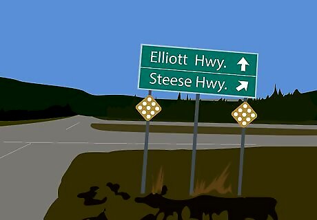
When you're ready, head on out. The actual highway doesn't start right out of town. You need to take the Elliot Highway (also known as AK 2) north approximately eighty miles to reach the junction for the Dalton. Turn onto the road and start the adventure.

Obey road laws. The road is a state highway, so standard road laws still apply. The speed limit is 50 mph (84 km/h) along the entire length of the road. Drive with headlights on at all times. Trucks have the right-of-way along the whole road, so pull over when one approaches. Watch for ice, slush, and potholes, as all are common along the road. Only certain parts of the road are paved, so drive accordingly.

Enjoy the scenery. You will drive through some of the most untouched, beautiful wilderness in the country, including wildflowers, boreal forest, ice-clad mountains, and sprawling arctic tundra. Wildlife abounds, and hiking and camping opportunities await, so it makes sense to pull over occasionally for photos and fresh air.
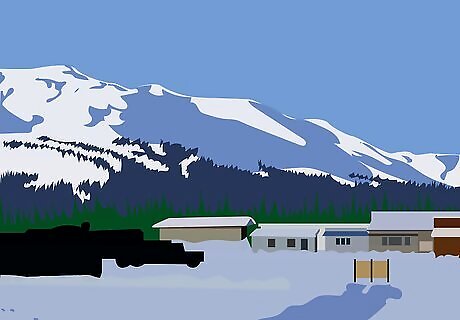
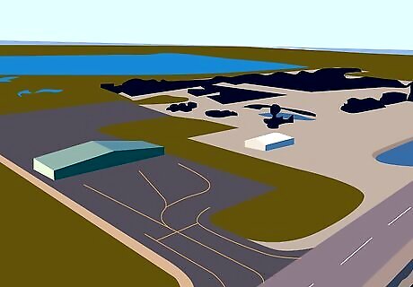
Arrive in Coldfoot. About 260 miles from Fairbanks, you'll arrive in Coldfoot, the main truck stop along the Dalton, at the foot of the Brooks Range mountains and the best stop to refill on supplies and gas. Visit the Arctic Interagency Visitor Center (milepost 175) to learn some more about the history of the area and of the Arctic. Staying the night is also a good idea. Be sure you are completely ready before leaving, as a long haul without services is ahead of you (see warnings below).
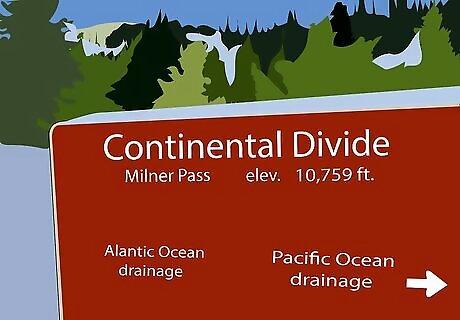
Drive out the rest of the highway to Deadhorse. Along the way, you'll cross the Continental Divide along Atigun Pass. The "Divide", is an imaginary line of high points that separates the flow of water into two great basins, mostly East-West. It follows the crest of the Brooks Range from the Seward Peninsula, then bends south into the Yukon and follows the Rocky Mountains and Sierra Madre Mountains south into South America. This divide separates the Pacific watershed from others. Here, rivers to the south head to the Pacific Ocean via the Yukon River and Bering Sea. North of here, rivers drain into the Arctic Ocean.
Arrive in Deadhorse. Deadhorse is the industrial camp supporting the Prudhoe Bay oilfields. You'll find some shops, museums and lodging options. Feel free to browse around. You'll almost certainly need to stay the night here.
Plan an Arctic tour. While access to the ocean is restricted for security reasons, the Arctic Caribou Inn offers guided tours. Look in the links below for the BLM Guide for a toll-free number.

Drive back to Fairbanks. This is the same as before, just in reverse. Remember the services shortage (again, see warnings below).

Congratulations! You've just done an adventure few people do!


Comments
0 comment