views
Amid a border standoff with India, China is ramping up infrastructure facilities at the disputed Aksai Chin border to facilitate smooth troop deployment near the Indian border. Beijing also released a new map in August this year asserting its claims over Aksai Chin and Arunachal Pradesh.
The development near the border comes even as the two countries have held several rounds of military talks, the latest being in August, aimed at confidence building and de-escalation.
Recently released satellite images have revealed China’s increased construction activity including roads and underground facilities in Aksai Chin area and expanding military infrastructure in both Aksai Chin and the Depsang Plains. It is also working to enhance its bridges and air facilities near the Indian border.
This tension between India and China escalated after a military standoff in May 2020 along the Line of Actual Control (LAC) after which the PLA troops have repeatedly transgressed disputed areas. Here’s a detailed look at China’s expanding military infrastructure near the western borders neighbouring India.
China Expanding Military Infra in Aksai Chin
China has built an extensive set of installations and ecosystems to support its troop deployments in the disputed Aksai Chin region by ramping up the construction of roads, outposts, bunkers and underground facilities.
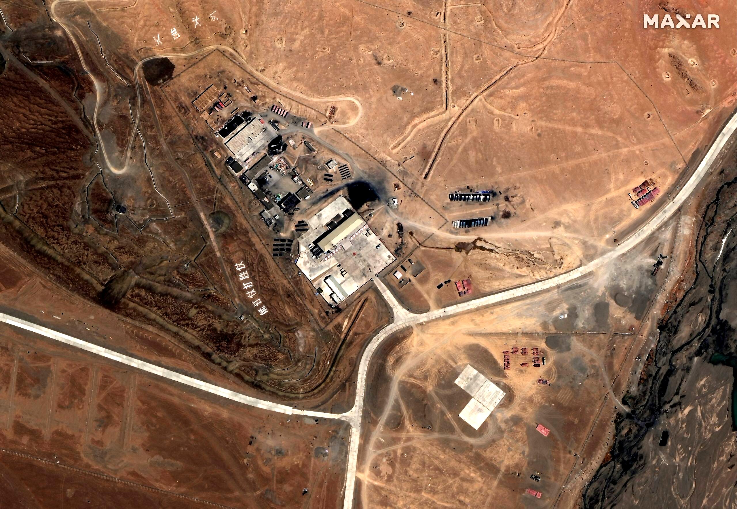
A comparison of satellite images from December 2021 and August 2023, provided by Maxar Technologies, shows the Chinese side has built reinforced bunkers and underground facilities at six locations within an area of roughly 15 sq km in Aksai Chin.

Moreover, images captured since October 2022 indicate that China has significantly expanded roads, established outposts, and built modern weatherproof camps equipped with parking areas, solar panels, and even helipads.
Beijing has also built underground facilities to protect sensitive equipment, ammunition and command posts from air or missile strikes during potential hostilities. It has also constructed a new heliport in the disputed territory, featuring 18 hangars and short runways that can accommodate helicopters and potentially drones.
China Releases New Official Map
China on August 28 released its 2023 edition of the “standard map of China” depicting Aksai Chin and Arunachal Pradesh as part of the country’s territory. The map was issued by China’s natural resources ministry as part of the annual “National Surveying and Mapping Promotion Day”.
The map also incorporates Taiwan, which China claims is part of its territory, and a large swathe of the South China Sea, where it has ongoing territorial disputes with several countries.

Earlier in April, China renamed 11 locations within Arunachal Pradesh, in a third attempt in recent years to rename locations in the northeastern state.
Highways and Bridges in Border Areas
China is also rapidly building infrastructure around Pangong Lake in Ladakh. According to reports, a bridge, nearing completion, will facilitate the rapid deployment of Chinese forces from the PLA’s Rutog military garrison to mountain ridges overlooking the lake. It is also constructing a “larger” second bridge over Pangong Tso Lake to help mobilize its troops faster in the region, as per sources.
Some of the planned highways near the Indian borders include:
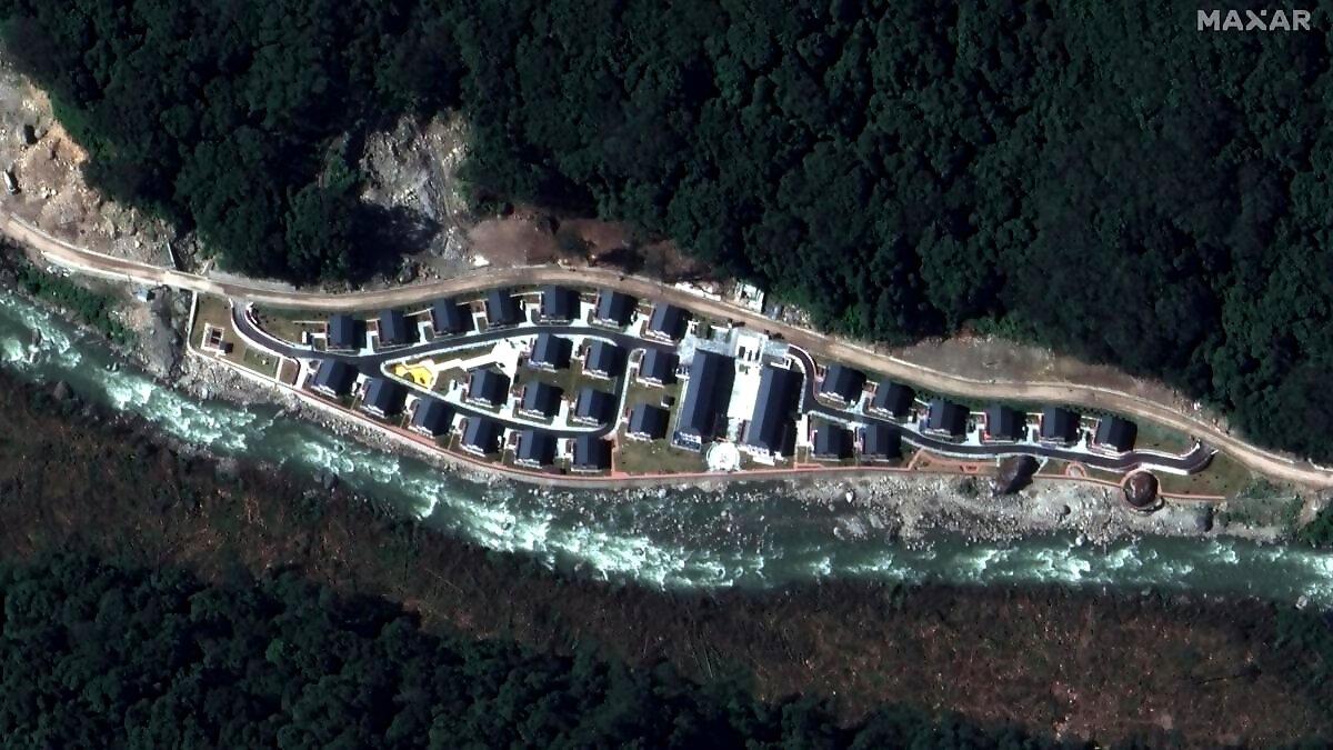
- G695 highway: China has planned to build G695 highway, slated to be completed in 2035, which will span the length of Aksai Chin, passing through the Depsang Plains, south of the Galwan Valley, and towards Pangong Tso. It is constructing modern villages, roads and railway lines in border areas of Tibet and Xinjiang.
- Depsang plains: It has also increased its activity in Depsang plains, a friction point in the Ladakh sector. The Chinese outposts in the Raki Nala region have the potential to obstruct Indian patrols in the area.
- G219 Highway: The National Highway 219 or G219, 2,086 kilometres in length, runs along the southwestern border of China from Yecheng in the Xinjiang Region to Lhatse in the Tibet Autonomous Region. The road, completed in 1957, passes through disputed area of Aksai Chin, which is claimed by India. Though the road was originally made of gravel, it was fully paved with asphalt in 2013.
Air Base Development Near Indian Borders
China is making significant and concerted efforts to enhance its air capabilities near the LAC and the border with Arunachal Pradesh. It has constructed an air defence site at the radar site near Cona County which is around 30 km from LAC and present in north of disputed India-Tibet border.
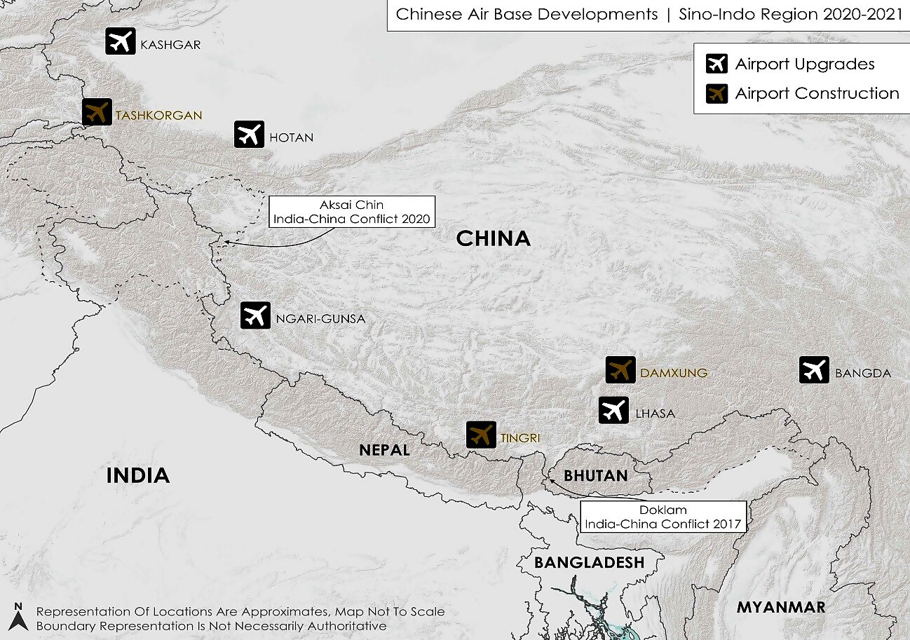
Beijing has been quietly building new airbases, expanding infrastructure to existing ones to turn them into dual-purpose airfields able to simultaneously host civil and military aircraft and mount around-the-clock offensive operations.

Some of the airports that have underwent upgrades near the LAC include: Kashgar, Tashkorgan, Hotan, Ngari- Gunsa, Tingri, Lahsa, Damsung and Bangda.
- Hotan Airbase: The airbase is less than 400 km from Ladakh and has been very active since the India-China standoff in 2020. The country has deployed almost all combat aircraft in PLAAF’s arsenal, including the J-20 stealth fighters at the airport. A Y-20 strategic transport aircraft and fifth-generation J-20 stealth fighters have been seen at the airbase in recent years.
- Tashkorgan Airbase: China is developing protected underground facilities at the airport in Tashkurgan. The high-altitude airport, still under construction, is often touted as the future base for Chinese ambitions in Central Asia.
- Ngari-Gunsa Airbase: The Ngari airbase and Gunsa airport cater to both civilian and military aircraft and can handle every aircraft in PLAAF right from fighter planes to big transport aircraft. It is located just 200 km from Pangong Lake, where Indian and Chinese troops are deployed eyeball-to-eyeball.
- Kashgar Airbase: China is constructing an underground vault construction in Kashgar airbase, that could be used to conceal nuclear warheads. The Kashgar airbase is 475 km away from the Karakoram Pass and is seen as a direct deployment against India. Like other airports near the border, the Kashgar airport serves a purpose- for both civilian and military use.
- Lhasa Gongkar Airbase: The airport, apart from serving Lhasa, also serves the Shigatse and Tsetang areas of Tibet. The airport has a new terminal building and a cargo complex under construction while a third airstrip is planned for further expansion.
- Shigatse Airbase: The dual-purpose airport located in Shigatse, close to Lhasa, is at a height of nearly 12,500 feet making it one of the highest airports in the world. Despite being at a high altitude, the airport has a runway of 5 km making it usable even for the biggest aircraft in the world. This airbase is north of Sikkim near the recent flashpoint of Doklam, giving the Chinese the option to rapidly deploy aircraft to the sensitive region in case the need arises.
- Near Taiwan Border: China is also upgrading three airbases located opposite Taiwan as tension continues to rage between the rival neighbours. China is adding and upgrading facilities at Longtian Airbase, Huian Airbase and Zhangzhou Airbase.
Deployment of Drones, Jets Near Arunachal
China has positioned its arsenal of drones and fighter jets at major Tibetan airbases, which are ranged against the Northeast India.
- A satellite image from December last year showed a state-of-the-art WZ-7 ‘Soaring Dragon’ drone at China’s Bangda Airbase located around 150 km from Arunachal Pradesh. The drone, unveiled for the first time in 2021, can fly non-stop for up to 10 hours and is designed for intelligence, surveillance, and reconnaissance missions.
- Another satellite image from December 2022 from Changdu Bangda Airport also showed Chinese-manufactured Sukhoi-30 fighter jet variant parked in the tarmac.
- China has also positioned at least 10 Flanker-type fighter jets on the tarmac of Shigatse Airport along with KJ-500 airborne early warning and control aircraft.
- Beijing has also placed WZ-7 high-altitude, long-endurance Unmanned Aerial Vehicles (UAVs) at the Nyingchi Mainling Airport, located around 15 kilometres from the border in the Northeast.


Comments
0 comment