views
“It is almost on the doorstep,” says senior India Meteorological Department scientist Dr DS Pai. “We are expecting good rains over Kerala during the next few days. The monsoon winds are strong, and if the rainfall activity is sustained, the monsoon could make its onset during the next 48 hours.”

The IMD has forecasted heavy rainfall over isolated parts of Kerala during June 6-10 and south interior Karnataka on June 9-10.
The monsoon season is beginning under the shadow of an evolving El Nino this year, and the delayed onset seems to have added to the worries. The latest update suggests the monsoon still remains far away from the coast, with its northern limit still passing through Minicoy, the southernmost island of Lakshadweep.
PROGRESS COULD BE SLUGGISH
While the seasonal rainfall may begin over Kerala in the next few days, as IMD suggests, further advance of the monsoon into the southern peninsular could be sluggish.
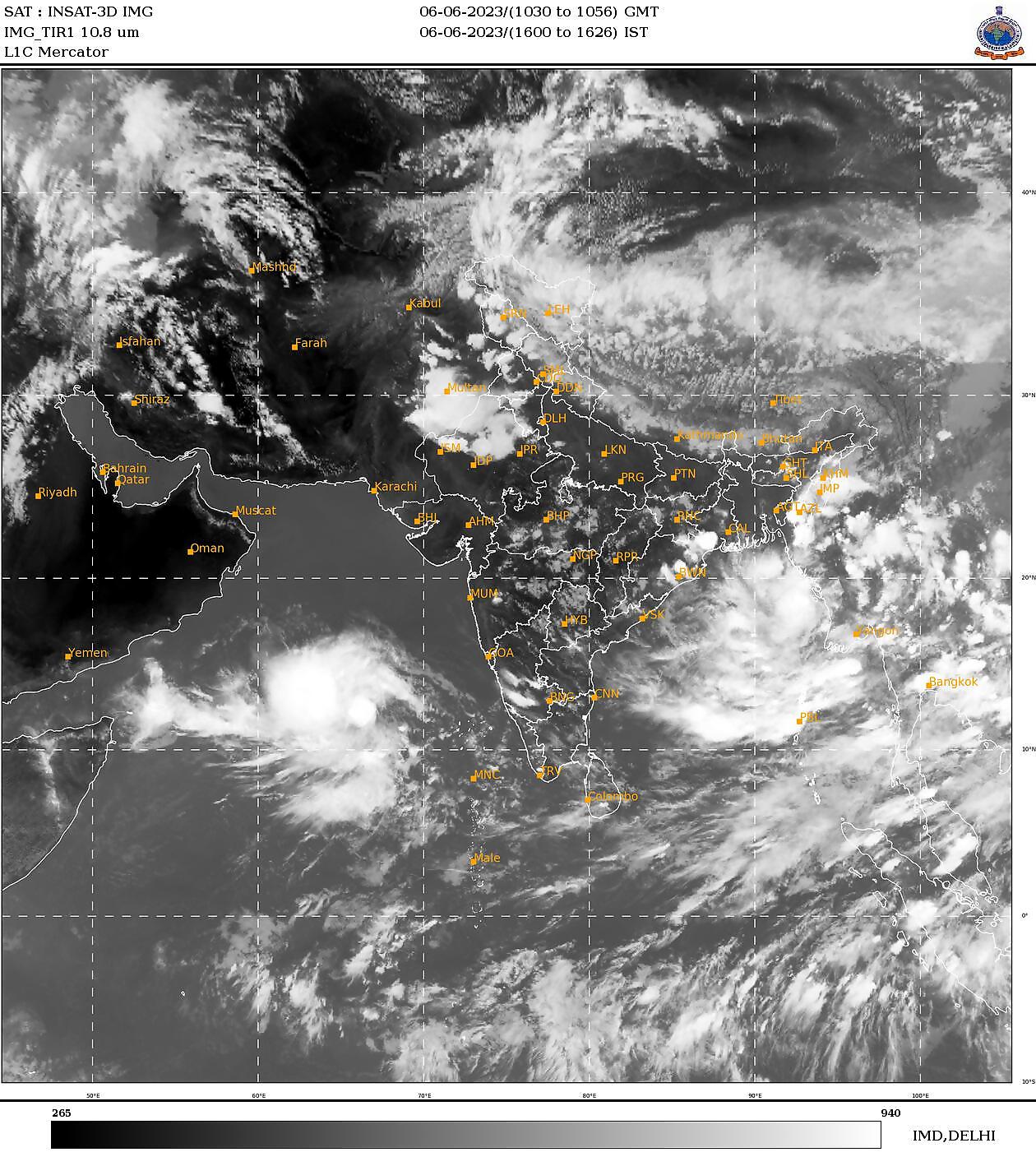
A low-pressure system that formed in the Arabian Sea on Monday evening has rapidly intensified into a depression over the same area by the early hours of Tuesday. These are subsequent stages to the formation of a cyclone. It is most likely to become a cyclonic storm (‘Biparjoy’) by Tuesday evening over the east-central Arabian Sea.

“The system is very strong. It will take in a lot of moisture from the seas which would have otherwise strengthened the monsoon. So, even though the onset will happen in the next few days, the further progress of the monsoon could be slightly subdued,” Dr Pai told News18. “But it depends on how the system evolves, and we are keeping a watch.”
LANDFALL OVER INDIAN COAST UNLIKELY
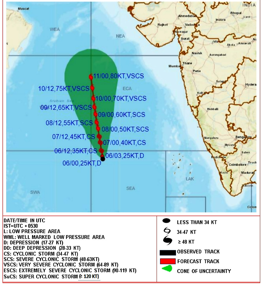
According to IMD, the storm is expected to continue moving nearly northwards over the next five days, and its landfall over the Indian coast seems unlikely. As of Tuesday afternoon, the system lay 950 km west-southwest of Goa, 1,100 km southwest of Mumbai, 1,190 km south-southwest of Porbandar, and 1,490 km south of Karachi.
The forecast suggests it will intensify further, turning into a severe cyclone by June 8 with winds in the ocean gusting up to 110-125 kmph. It is then expected to become a very severe cyclonic storm by June 9 with winds gusting up to 160-170 kmph by June 11. The sea conditions are set to be very rough, and fishermen warnings have been issued already.
NO RESPITE FROM HEATWAVE FOR BIHAR, WEST BENGAL
East-central India, on the other hand, continues to reel under the impact of searing summer heat, with no respite expected soon. The severe heatwave conditions have scorched parts of Bihar and West Bengal over the last six days.
The department has further warned of heatwave conditions over large parts of east-central India including Bihar, Jharkhand, West Bengal, as well as Andhra Pradesh and Telangana during June 6-10. Uttar Pradesh may also expect similar conditions during the coming days.
The maximum temperatures continue to hover around 40-42°C over many parts of central, east, and north Peninsular India.
They will further rise by 2-4°C in northwest India during the next five days and by 2-3°C over central India during the next three days.


Comments
0 comment